地理漫步·世界地理英语30篇(1)
25 / 30
正在确认阅读权限…
Ganges Delta Floodplain Farming and Silt Enrichment
恒河三角洲洪泛农业与淤泥富集
-
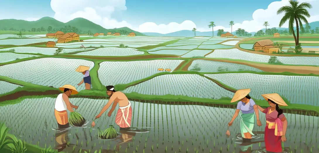
The Ganges Delta spans Bangladesh and eastern India, forming the world's largest active delta.恒河三角洲横跨孟加拉国和印度东部,是全球最大的活跃三角洲。
-
Annual monsoon floods deposit nutrient-rich silt across vast low-lying farmlands each year.每年季风洪水将富含养分的淤泥沉积到广阔的低洼农田上。
-
Farmers time rice planting to coincide with receding floodwaters and fresh sediment layers.农民根据退水时间和新沉积层安排水稻种植。
-
This natural fertilization reduces dependence on synthetic inputs while sustaining high yields.这种天然施肥方式降低了对化肥的依赖,同时维持高产。
-
However, embankments and upstream dams increasingly disrupt the flood pulse and sediment supply.然而,堤坝和上游水坝正日益干扰洪水脉冲和泥沙供给。
-
Salinity intrusion during dry seasons also threatens soil fertility in southern delta zones.旱季盐水入侵也威胁着三角洲南部地区的土壤肥力。
-
Floating gardens, built on water hyacinth rafts, offer adaptive cultivation where land is seasonally submerged.浮园以凤眼莲为筏,在季节性淹没区实现适应性耕作。
-
Tidal channels and mangrove belts buffer storm surges but shrink under aquaculture pressure.潮汐水道与红树林带可缓冲风暴潮,却在水产养殖压力下不断萎缩。
-
Delta subsidence and sea-level rise compound flood risks for over 150 million residents.三角洲沉降与海平面上升叠加,加剧了1.5亿多居民的洪灾风险。
-
Sustainable management must balance rice production, fisheries, and wetland conservation.可持续管理须统筹水稻生产、渔业与湿地保护。