地理漫步·世界地理英语精读30篇(5)
16 / 30
正在确认阅读权限…
The Suez Canal Corridor Development: Logistics Geography and the Reconfiguration of Afro-Eurasian Trade Corridors
苏伊士运河走廊开发:物流地理与亚非欧贸易通道重构
-
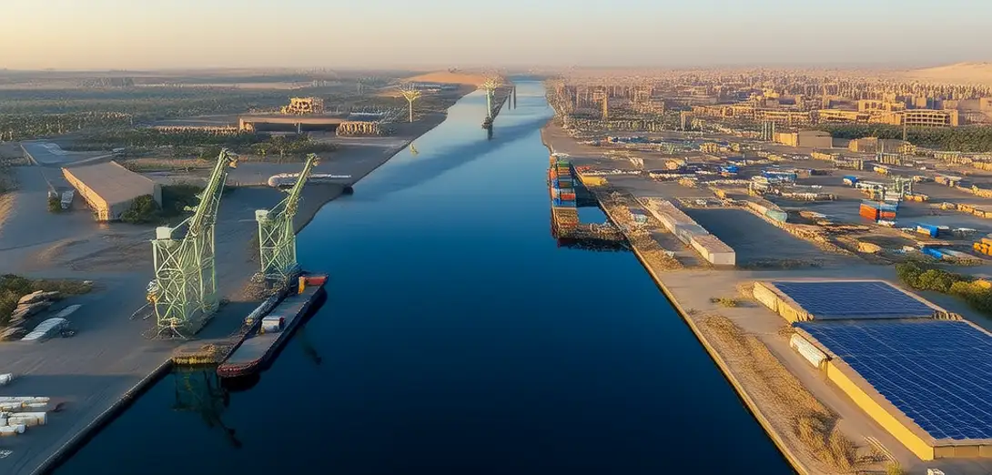
Egypt’s $8 billion Suez Canal Corridor Project reframes the canal not as maritime chokepoint but as a terrestrial logistics spine anchoring industrial zones.埃及耗资80亿美元的苏伊士运河走廊项目,不再将运河视为海上咽喉要道,而是重塑为支撑工业区的陆路物流主干。
-
New dry ports near Ain Sokhna integrate rail, pipeline, and fiber-optic infrastructure to reroute cargo flows away from congested Mediterranean hubs.靠近艾因苏赫纳的新建旱港整合铁路、管道与光纤基础设施,将货流从拥堵的地中海枢纽分流。
-
Geopolitical volatility has accelerated corridor development, yet labor migration patterns reveal deep mismatches between projected skill demands and local training capacity.地缘政治动荡加速了走廊建设,但劳动力迁移模式显示,预估技能需求与本地培训能力之间存在严重错配。
-
Satellite-derived nighttime light data shows rapid electrification along the corridor, contrasting sharply with persistent energy poverty in adjacent governorates.卫星夜间灯光数据表明走廊沿线电力普及迅速,而邻近省份却长期深陷能源贫困。
-
The project’s spatial logic prioritizes transit efficiency over regional equity—most new jobs require technical English fluency inaccessible to rural secondary graduates.该项目的空间逻辑重 transit 效率轻区域公平——多数新增岗位要求技术英语能力,农村高中毕业生难以企及。
-
Transit fees now fund desalination plants serving corridor industries, creating a hydrological feedback loop between trade volume and freshwater access.过境费如今用于资助服务走廊产业的海水淡化厂,形成贸易量与淡水获取之间的水文反馈循环。
-
Chinese and Emirati investors shape corridor zoning laws, embedding foreign regulatory templates into Egypt’s territorial planning code.中阿投资者主导走廊分区法规制定,将外国监管模板嵌入埃及国土规划法典。
-
Local fishermen displaced by port expansions negotiate compensation not in cash but in priority access to newly built cold-storage facilities.因港口扩建而失地的当地渔民,以优先使用新建冷库作为补偿,而非现金赔付。
-
Academic debates center on whether the corridor reinforces extractive global value chains or enables sovereign industrial diversification.学界争论焦点在于:该走廊是强化全球掠夺性价值链,还是推动国家自主工业多元化?
-
Mapping the corridor’s evolution requires analyzing customs declarations alongside groundwater depletion rates in Sinai’s aquifers.追踪走廊演变需同步分析海关申报数据与西奈半岛含水层地下水枯竭速率。
-
Its success hinges less on ship throughput than on recalibrating the geography of opportunity across Egypt’s socio-spatial fault lines.其成败关键不在船舶通行量,而在重新校准埃及社会空间断层线上的机会地理分布。
-
This is infrastructure as territorial argument—not just moving goods, but asserting a new political economy of place.这是以基础设施为领土主张——不仅运输货物,更宣示一种新的地方政治经济秩序。