正在确认阅读权限…
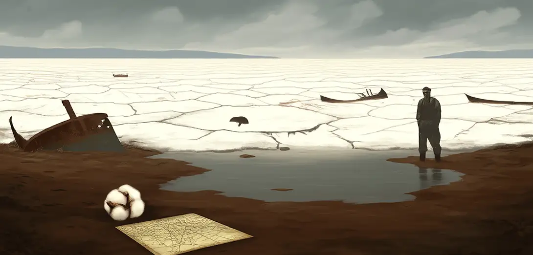
The Aral Sea Collapse: A Cautionary Tale of Hydro-Political Myopia
咸海消亡:水文政治短视的警示录
-
Once the world’s fourth-largest lake, the Aral Sea has shrunk to less than 10 percent of its 1960 volume—not from climate change, but from deliberate Soviet-era irrigation diversions that prioritized cotton monoculture over basin-wide hydrologic balance.曾为世界第四大湖的咸海,如今水量不足1960年的10%,主因并非气候变化,而是苏联时期为发展棉花单一种植而刻意截流灌溉,牺牲了整个流域的水文平衡。
-
The Amu Darya and Syr Darya rivers, diverted to feed 4.5 million hectares of cotton fields, now deliver less than 12 percent of their historic flow to the sea, transforming a dynamic aquatic ecosystem into a toxic dust bowl.阿姆河与锡尔河被 diverted 用于灌溉450万公顷棉田,流入咸海的水量不足历史径流量的12%,将生机勃勃的水生生态系统变为有毒沙尘盆地。
-
Salinity levels rose from 10 g/L to over 100 g/L, collapsing endemic fish stocks and triggering the collapse of the regional fishing economy that once employed 60,000 people.盐度从10克/升飙升至逾100克/升,导致特有鱼类种群崩溃,并使曾养活6万人的区域渔业经济彻底瓦解。
-
Cotton subsidies in Uzbekistan continue to incentivize water-intensive cultivation despite national pledges under the UNCCD to restore sustainable water use ratios.乌兹别克斯坦持续补贴棉花种植,刺激高耗水耕作,与其在《联合国防治荒漠化公约》下承诺恢复可持续用水比例的国家义务相悖。
-
The Northern Aral Sea rebound—achieved via the Kok-Aral Dam—demonstrates technical feasibility but also exposes geopolitical asymmetry: Kazakhstan invested in restoration while Uzbekistan focused on upstream dam construction for hydropower.北咸海的复苏——依托科卡拉尔大坝实现——虽验证了技术可行性,却也凸显地缘政治失衡:哈萨克斯坦投资生态修复,乌兹别克斯坦则专注上游水电大坝建设。
-
Dust storms carrying pesticide-laden sediments from exposed seabeds now travel over 500 kilometers, increasing child asthma rates in Tajikistan’s Fergana Valley by 32 percent per WHO epidemiological modeling.裹挟农药残留沉积物的沙尘暴从裸露湖床升起,最远扩散超500公里,据世卫组织流行病学模型,致使塔吉克斯坦费尔干纳谷地儿童哮喘发病率上升32%。
-
Transboundary water treaties remain non-binding, with the Interstate Commission for Water Coordination lacking enforcement mechanisms beyond peer review and diplomatic pressure.跨境水资源条约仍无法律约束力,中亚水资源协调委员会除同行评议与外交施压外,缺乏任何执行机制。
-
Remote sensing data shows groundwater tables dropping 1.8 meters annually near major irrigation canals, revealing that surface diversion has triggered subsurface depletion far beyond immediate command areas.遥感数据显示,主要灌溉渠沿线地下水位年均下降1.8米,表明地表取水已引发远超灌区范围的深层地下水枯竭。
-
Cotton export revenues fund 40 percent of Uzbekistan’s foreign exchange, creating structural resistance to cropping-system reforms despite evidence that drip irrigation could cut water use by 45 percent.棉花出口收入占乌兹别克斯坦外汇总额的40%,形成对种植制度改革的结构性阻力,尽管滴灌技术可节水45%已有实证。
-
The Southern Aral Sea is now officially classified as a desert—not an ecosystem in decline, but a landscape formally re-categorized by geographers and remote-sensing classifiers.南咸海已被正式划归为沙漠——它不再是一个退化的生态系统,而是被地理学家与遥感分类系统明确认定的新地貌类型。
-
Academic literature increasingly frames the disaster not as ‘mismanagement’ but as ‘hydrological colonialism’: the imposition of centralized, production-oriented water logic onto decentralized, adaptive riparian cultures.学界日益将这场灾难定性为‘水文殖民主义’而非‘管理不善’:即以中央集权、生产导向的用水逻辑,强行取代沿河社群原本分散、适应性的用水文化。
-
Its legacy endures not in water, but in policy DNA: every major Central Asian infrastructure proposal still triggers reflexive scrutiny for Aral-like externalities.其遗产并未存于水中,而在政策基因里:中亚所有重大基建提案,至今仍会本能触发对咸海式外部效应的审慎评估。