地理漫步·世界地理英语30篇(4)
26 / 30
正在确认阅读权限…
The Tibetan Plateau: Atmospheric Pump and High-Altitude Hydrological Divide
青藏高原:大气泵与高海拔水文分界
-
Rising over four thousand meters, this plateau acts as a thermal engine driving monsoon circulation.海拔逾四千米,该高原犹如热力引擎,驱动季风环流。
-
Its elevated surface heats air faster than surrounding lowlands, creating seasonal pressure gradients.其抬升的地表比周边低地更快加热空气,形成季节性气压梯度。
-
Glaciers on its northern slopes feed the Yangtze, Yellow, and Mekong rivers through meltwater channels.北坡冰川融水经河道补给长江、黄河与湄公河。
-
The plateau’s southern edge marks where moisture-laden Indian monsoon winds first rise and cool.高原南缘是饱含水汽的印度季风首次抬升冷却之处。
-
Permafrost distribution follows latitude and elevation, forming discontinuous zones that affect groundwater storage.多年冻土分布受纬度与海拔控制,形成影响地下水储存的不连续带。
-
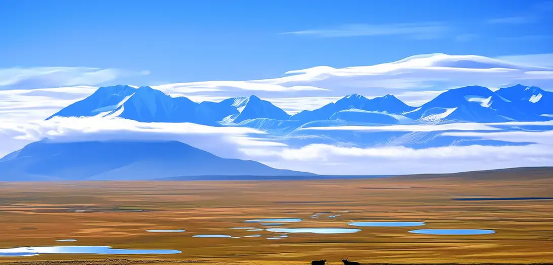
Lake basins like Nam Co occupy tectonic depressions where evaporation exceeds precipitation year-round.纳木错等湖盆位于构造沉降区,全年蒸发量大于降水量。
-
Wind erosion sculpts aeolian landforms on arid western margins far from major river systems.风蚀在远离主要河流系统的西部干旱边缘塑造风成地貌。
-
Seasonal snow cover varies spatially, influencing spring runoff timing across three major Asian river basins.季节性积雪覆盖空间差异显著,影响亚洲三大河流流域的春季径流时间。
-
High-elevation wetlands store carbon in peat despite thin soils and cold temperatures.高海拔湿地虽土壤浅薄、气温寒冷,仍以泥炭形式固存碳。
-
River networks here show dendritic patterns constrained by regional fault lines and bedrock resistance.此处河网呈树枝状,受区域断层线与基岩抗蚀性制约。