正在确认阅读权限…
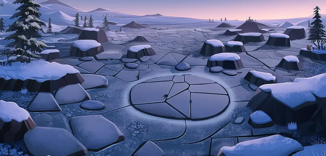
Periglacial Landscapes: Frost Action Shapes Terrain Beyond Glaciers
冻缘地貌:冰缘作用在冰川之外塑造地形
-
Freeze-thaw cycles crack bedrock and sort stones into patterned ground without glacial ice.冻融循环使基岩开裂,并在无冰川冰的情况下将石块排列成有规律的地貌。
-
Solifluction flows occur when waterlogged soil moves slowly over frozen subsoil on gentle slopes.当饱水土壤在缓坡上缓慢滑过冻结的下层土时,便发生泥流作用。
-
Pingos—ice-cored hills—form where groundwater freezes and lifts overlying sediments upward.冰核丘是冰芯隆起形成的山丘,由地下水冻结并抬升上覆沉积物而成。
-
Patterned ground includes polygons, stripes, and circles shaped by differential frost heave intensity.多边形、条带和环状等有规律的地貌,由差异性冻胀强度塑造而成。
-
Permafrost degradation thaws previously stable slopes, triggering retrogressive thaw slumps in Arctic tundra.多年冻土退化使原本稳定的斜坡解冻,从而在北极苔原引发后退式热融滑塌。
-
Rock glaciers move imperceptibly slow but transport debris far beyond active glacier termini.石冰川移动极其缓慢,却能将碎屑搬运至活跃冰川末端之外很远的地方。
-
Frost wedging dominates erosion in high-altitude deserts where snow cover is thin but temperature swings extreme.在积雪稀薄但温差极大的高海拔沙漠中,冻融风化是主要侵蚀方式。
-
Thermokarst lakes form when ground ice melts, leaving depressions that fill with rainwater and runoff.地下冰融化后形成凹陷,雨水和径流注入其中,便发育为热融湖。
-
These landscapes span latitudinal bands where mean annual temperatures hover near zero degrees Celsius.这些地貌分布于年均气温接近0℃的纬度带。
-
Remote sensing now tracks periglacial change rates to model future terrain instability under warming.遥感技术现已用于监测冻缘区变化速率,以模拟气候变暖下的未来地形失稳。