地理漫步·世界地理英语30篇(1)
11 / 30
正在确认阅读权限…
Lop Nur Drying and Ecological Warning
罗布泊干涸与生态警示
-
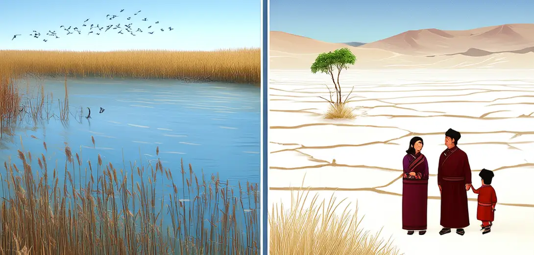
Lop Nur, once China’s largest inland lake and a terminal basin for the Tarim River, dried completely by the late 1970s after decades of upstream diversion.罗布泊曾是中国最大的内陆湖,也是塔里木河的尾闾湖,但经过数十年上游截流,到20世纪70年代末彻底干涸。
-
Cotton farms and reservoirs along the river’s course captured over 90% of its flow, leaving nothing to replenish the desert basin.沿河棉田与水库截留了逾90%的河水,致使沙漠盆地再无水源补给。
-
What remains is a vast, cracked salt crust—over 10,000 km² of white expanse visible from space and nicknamed ‘the ear of the Earth’.如今只剩一片广袤龟裂的盐壳——面积超1万平方公里,从太空清晰可见,被戏称为‘地球之耳’。
-
Dust storms now lift toxic salts from exposed lakebeds, degrading air quality across Xinjiang and damaging crops hundreds of kilometers away.沙尘暴卷起裸露湖床中的有毒盐分,严重恶化新疆空气质量,并损毁数百公里外的农作物。
-
Former lakeside settlements like Loulan lie buried under shifting sands, their wooden pillars preserved in extreme aridity but inaccessible to most researchers.楼兰等昔日湖畔聚落已被流沙掩埋,其木质立柱虽因极端干旱得以保存,却大多难以供研究人员探查。
-
Ecologists study remnant poplar groves along surviving oases—genetic reservoirs that may hold clues for drought-resistant reforestation.生态学家研究残存绿洲边缘的胡杨林——这些基因宝库或可为抗旱造林提供关键线索。
-
Satellite time-series reveal seasonal greening near river diversions, confirming that targeted water releases can revive fragmented riparian corridors.卫星时序影像显示,河道分流点附近出现季节性返青,证实精准调水可复苏破碎化的河岸植被带。
-
School textbooks now include Lop Nur as a case study in unsustainable water governance—not just environmental loss, but cultural severance.中小学课本已将罗布泊列为水资源治理失当的典型案例——损失的不仅是环境,更是文化纽带。
-
Restoration pilots divert flood pulses downstream during spring thaw, mimicking natural flow regimes to nourish tamarisk roots and stabilize dunes.修复试点项目在春季融雪期向下游释放洪峰水流,模拟自然水文节律,以滋养柽柳根系、稳固沙丘。
-
Lop Nur stands as both grave and guide: a warning etched in salt, and a lesson in restoring balance before silence becomes irreversible.罗布泊既是墓碑,亦是路标:以盐为墨写就的警示,亦是恢复生态平衡前的最后教诲。