地理漫步·世界地理英语30篇(1)
15 / 30
正在确认阅读权限…
Okavango Delta Flood Pulse and Habitat Mosaics
奥卡万戈三角洲洪水脉冲与生境镶嵌
-
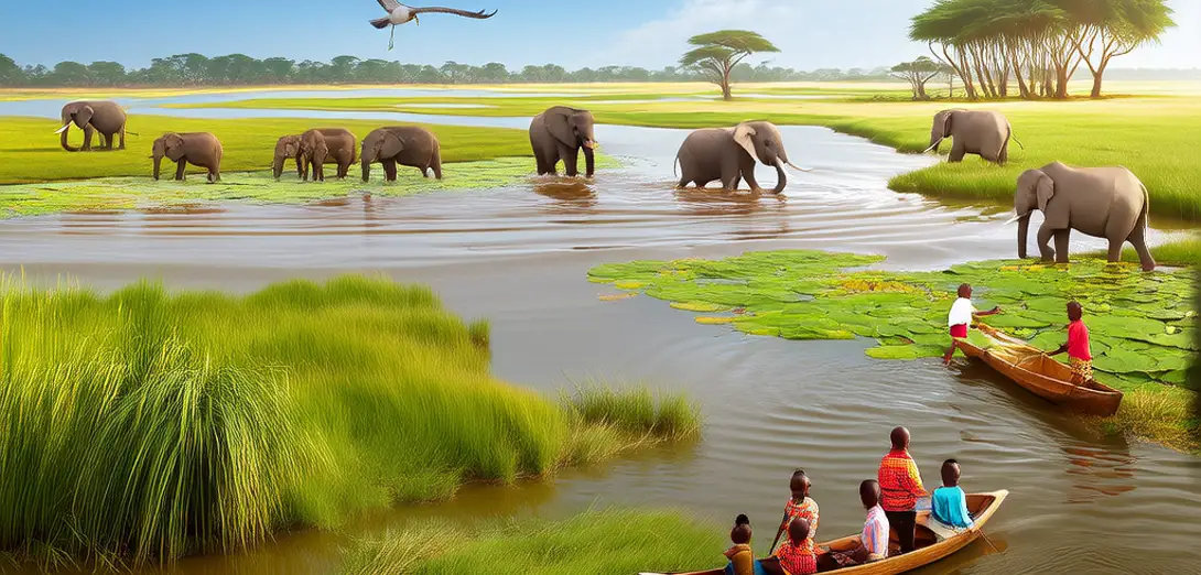
The Okavango Delta forms where the Okavango River ends inland in northern Botswana, never reaching the sea.奥卡万戈三角洲位于博茨瓦纳北部内陆,是奥卡万戈河的终点,河水从未入海。
-
Annual floodwaters arrive eight months after rainfall in Angola’s highlands, delayed by flat topography and sandy soils.每年洪水在安哥拉高地降雨后八个月抵达,受平坦地形和沙质土壤延缓。
-
Peak flooding transforms dry savanna into a 15,000 km² wetland mosaic of palm islands, papyrus channels, and seasonal lagoons.洪水高峰期将干旱草原变为面积约1.5万平方公里的湿地景观,包含棕榈岛、纸莎草水道和季节性泻湖。
-
Water depth and duration determine plant zonation: reeds dominate shallow margins, while deep-water channels host submerged macrophytes.水深与持续时间决定植被分布:浅水边缘以芦苇为主,深水河道则生长沉水大型植物。
-
Flood recession exposes nutrient-rich sediments, triggering rapid grass regrowth that sustains migratory herbivores like elephants and zebras.退水后裸露的富营养沉积物促使牧草迅速再生,支撑大象、斑马等迁徙食草动物。
-
Island size and elevation control tree species composition, with hyphaene palms thriving only on stable, older landforms.岛屿面积与海拔决定树种组成,海枣棕榈仅见于稳定且古老的陆地地貌。
-
Human settlements cluster on higher ground, avoiding annual inundation but increasingly facing water-table decline during dry years.人类聚居点集中在地势较高处,避开年度淹没,但旱年地下水位下降问题日益突出。
-
Satellite imagery reveals how flood extent varies by ±30% annually, altering wildlife movement corridors and predator-prey encounter rates.卫星影像显示,每年洪水范围波动达±30%,改变野生动物迁徙廊道及捕食者与猎物相遇频率。
-
Local hydrological knowledge guides traditional fishing and cattle grazing across shifting wet-dry ecotones.当地水文知识指导传统捕鱼与牛群放牧,适应干湿交错带的动态变化。
-
Climate models project more erratic flood timing, threatening the delta’s delicate balance between permanent swamps and seasonal floodplains.气候模型预测洪水时间将更不稳定,威胁三角洲永久沼泽与季节性洪泛平原间的微妙平衡。