地理漫步·世界地理英语30篇(3)
15 / 30
正在确认阅读权限…
Lake Chad Basin: Hydrological Fragility in a Shifting Climate Zone
乍得湖流域:气候过渡带中的水文脆弱性
-
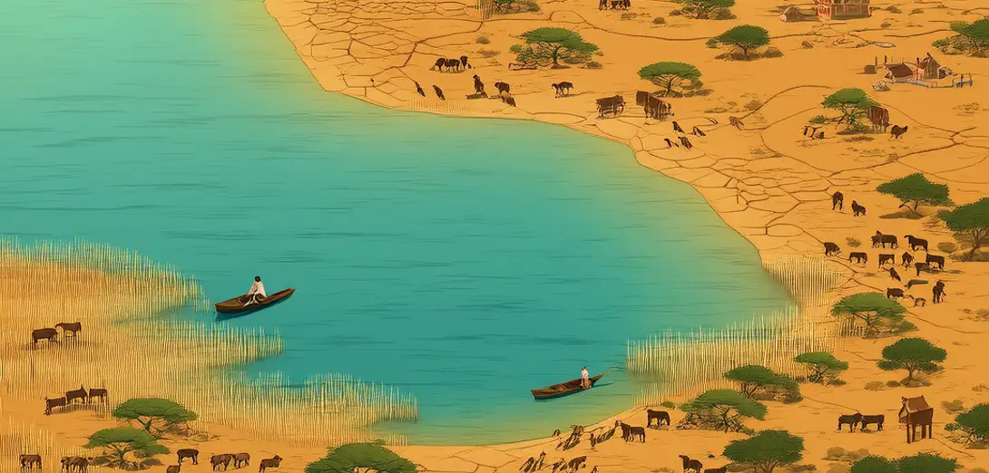
Lake Chad, straddling Chad, Cameroon, Niger, and Nigeria, occupies a Sahelian transition zone between savanna and desert.乍得湖横跨乍得、喀麦隆、尼日尔和尼日利亚,地处萨赫勒地带,位于稀树草原与沙漠之间的过渡区。
-
Its surface area has shrunk by over 90% since the 1960s due to reduced rainfall and increased irrigation withdrawals.受降雨减少和灌溉取水增加影响,其表面积自20世纪60年代以来已萎缩逾90%。
-
Unlike tectonic or volcanic lakes, Chad is a shallow, endorheic basin fed mainly by the Chari River’s seasonal floods.与构造湖或火山湖不同,乍得湖是一个浅层内流盆地,主要依靠沙里河的季节性洪水补给。
-
Evaporation exceeds inflow during prolonged droughts, exposing vast mudflats that alter regional albedo and dust emission.长期干旱期间,蒸发量超过入流量,大片泥滩裸露,改变区域反照率和沙尘排放。
-
Transboundary water management remains weak despite shared dependence on this shrinking hydrological node.尽管各国共同依赖这一日益萎缩的水文节点,跨境水资源管理依然薄弱。
-
Aquifer recharge depends critically on floodplain infiltration during high-flow years—a process increasingly disrupted.含水层补给高度依赖丰水年份洪泛区的入渗——而这一过程正日益受阻。
-
Vegetation belts migrate southward as groundwater tables drop, intensifying pastoralist-farmer land-use conflicts.随着地下水位下降,植被带向南迁移,加剧了牧民与农民之间的土地利用冲突。
-
Satellite data show seasonal lake expansion now occurs later and contracts earlier each year on average.卫星数据显示,湖泊季节性扩张如今平均每年推迟,而收缩则提前。
-
Sediment cores from basin margins record centuries of wet-dry oscillations linked to Atlantic sea-surface temperature shifts.湖盆边缘沉积岩芯记录了数百年来与大西洋海表温度变化相关的干湿交替。
-
Restoration efforts focus on re-establishing natural flood pulses rather than static water-level targets.修复工作聚焦于恢复自然洪水脉冲,而非设定静态水位目标。