地理漫步·世界地理英语30篇(3)
26 / 30
正在确认阅读权限…
The Yucatán Karst Aquifer: Subterranean Hydrology Shaped by Limestone Dissolution
尤卡坦喀斯特含水层:由石灰岩溶蚀塑造的地下水文系统
-
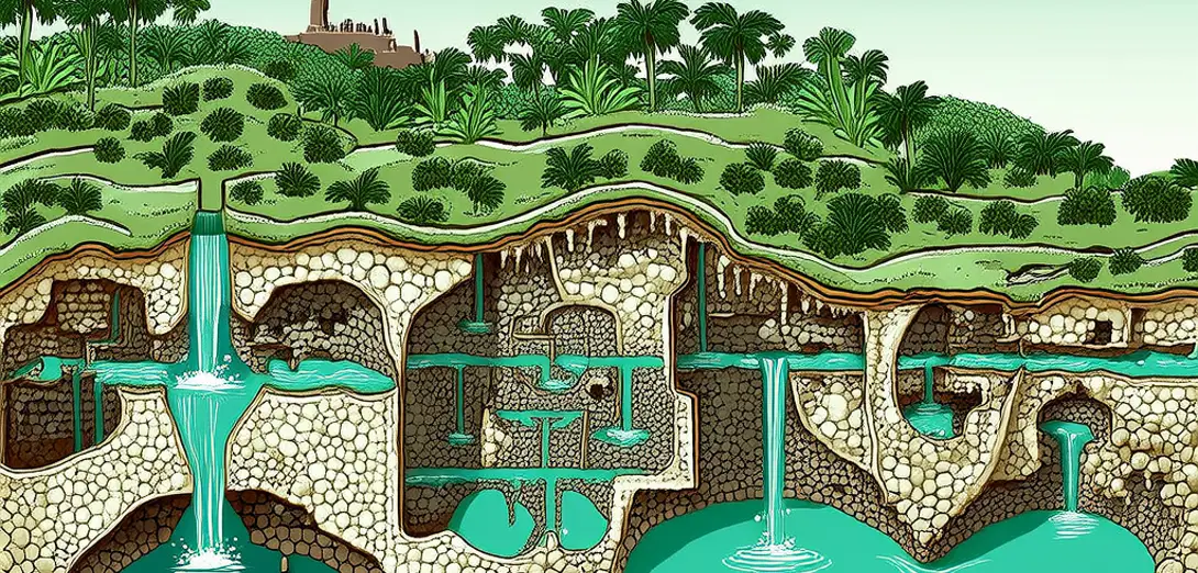
Beneath the Yucatán Peninsula lies one of Earth’s largest contiguous freshwater aquifers formed in porous limestone.尤卡坦半岛地下蕴藏着地球上最大的连续淡水含水层之一,由多孔石灰岩构成。
-
Rainwater percolates rapidly through sinkholes called cenotes, which serve as natural portals to the aquifer.雨水经由名为“天坑”的落水洞快速渗入,这些天坑是通往含水层的天然入口。
-
The aquifer’s geometry reflects millennia of dissolution along fractures controlled by regional tectonic stress fields.含水层的形态反映了数千年间受区域构造应力场控制的断裂带溶蚀过程。
-
Saltwater intrusion occurs where freshwater pressure drops near the coast, creating a dynamic halocline interface.沿海地区淡水压力下降时发生海水入侵,形成动态的盐度分界面。
-
Cenote distribution maps reveal alignment with buried fault lines rather than surface topography alone.天坑分布图显示其走向与隐伏断层线吻合,而不仅取决于地表地形。
-
Isotopic tracing shows some groundwater travels over 100 km underground before emerging at coastal springs.同位素示踪表明,部分地下水在地下流动逾100公里后才从滨海泉眼涌出。
-
Urban expansion in Mérida increasingly stresses recharge zones previously protected by native vegetation cover.梅里达市不断扩张,日益加剧对曾由原生植被覆盖保护的补给区的压力。
-
Cave surveys document submerged river passages that function as subsurface drainage during heavy rains.洞穴勘测记录了淹没的河道通道,暴雨期间它们充当地下排水通道。
-
This aquifer demonstrates how lithology, not just climate, governs water storage and flow in tropical lowlands.该含水层表明,在热带低地,岩性而非仅气候决定水资源的储存与运移。
-
Its fragility underscores why karst systems require three-dimensional management across surface and subsurface domains.其脆弱性凸显了喀斯特系统需在地表与地下三维空间内统筹管理。