地理漫步·世界地理英语30篇(3)
28 / 30
正在确认阅读权限…
The Tibetan Plateau Periglacial Zone: Cryo-geomorphic Feedback Loops in High-Altitude Aridity
青藏高原冻缘带:高海拔干旱区中的冰缘地貌反馈回路
-
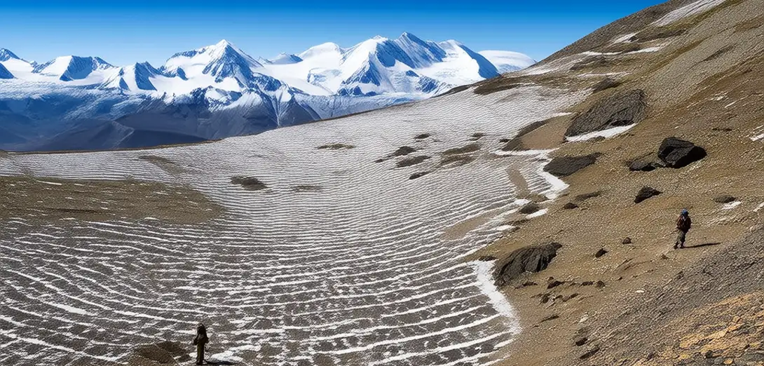
At 4,500–5,200 meters, the Tibetan Plateau hosts the world’s highest and most extensive periglacial zone outside polar regions.青藏高原海拔4500–5200米区域,拥有极地以外全球最高、最广的冻缘带。
-
Frost heave, solifluction, and patterned ground emerge where thin active layers interact with underlying ice-rich permafrost.当薄活动层与下伏富冰多年冻土相互作用时,便出现冻胀、融冻泥流和多边形土等现象。
-
Wind erosion intensifies on degraded slopes where vegetation loss exposes frozen sediments to aeolian abrasion.植被退化导致坡面裸露,冻结沉积物直接受风力磨蚀,风蚀加剧。
-
Thawing permafrost alters slope stability, triggering rockfalls that expose fresh bedrock to rapid chemical weathering.多年冻土融化改变坡体稳定性,诱发岩崩,使新鲜基岩暴露并快速发生化学风化。
-
Remote sensing detects expanding thermokarst lakes whose growth rates correlate with local snowpack duration anomalies.遥感监测发现热喀斯特湖持续扩张,其扩张速率与当地积雪期异常呈正相关。
-
These lakes drain abruptly when ice-walled conduits collapse, reshaping valley-floor sediment transport networks.当冰壁导水通道坍塌时,这些湖泊骤然排水,重塑谷底沉积物输运网络。
-
Albedo shifts from snow-covered to debris-covered surfaces accelerate localized warming in feedback cycles observable at sub-kilometer scale.地表反照率由积雪覆盖转为碎屑覆盖,引发局地增暖,在亚千米尺度上形成可识别的正反馈循环。
-
Pastoral land-use changes modify surface insulation, making some areas more vulnerable to frost-table oscillation.牧业用地变化改变地表隔热性,使部分区域更易受冻土上限波动影响。
-
This zone exemplifies how cryospheric processes structure landscapes even without glaciers present.该区域表明:即使无冰川存在,冰冻圈过程仍可塑造地貌。
-
Its sensitivity makes it a critical indicator for detecting non-linear responses to atmospheric warming.其高度敏感性使其成为探测大气变暖非线性响应的关键指示区。