历史小径·世界史英语精读30篇(5)
20 / 30
正在确认阅读权限…
Funeral Processional Routes as Cartographic Counter-Memory in Edo-period Kyoto
江户时代京都葬礼行进路线作为制图式反记忆
-
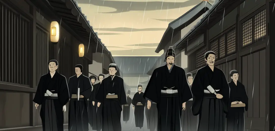
Kyoto’s Tokugawa-era funeral processions followed precise routes that deliberately bypassed shogunal checkpoints and avoided main thoroughfares reserved for daimyo processions.京都江户时代德川幕府时期的送葬队伍严格遵循特定路线,刻意绕开幕府关卡,避开专供大名队伍通行的主干道。
-
These alternative paths—documented in temple diaries and merchant guild ledgers—mapped social hierarchies through omission rather than inscription.这些替代路线——见于寺庙日记与商行账簿——并非通过明确记载,而是借由刻意省略来映射社会等级。
-
By traversing narrow alleyways and crossing temple precincts without permission, mourners enacted quiet resistance to status-based spatial control.送葬者穿行狭窄小巷、未经许可穿越寺院境内,以静默方式抵抗基于身份的空间管控。
-
The route’s rhythm—pausing at specific stone markers for sutra chanting—created temporal intervals where political time temporarily dissolved.队伍节奏——在特定石标前停驻诵经——创造出时间间隔,使政治时间暂时消解。
-
Modern GIS reconstructions show how these paths formed a shadow cartography intersecting but never overlapping official domain maps.现代GIS复原显示,这些路线构成一幅‘影子地图’,与官方领地地图相交却不重叠。
-
City officials in 1832 attempted to standardize mourning routes, provoking protests from Buddhist sects who cited century-old precedent.1832年,京都官员试图统一丧葬路线,引发佛教宗派抗议,理由是此举违背百年成例。
-
Contemporary Kyoto preservationists use these historical itineraries to advocate for pedestrian-only corridors in gentrifying districts.当代京都遗产保护者利用这些历史路线,推动在士绅化街区设立步行专用通道。
-
Unlike Western monumental cemeteries, Edo Kyoto’s funerary geography was dispersed, mobile, and intentionally unmonumental.与西方宏大的纪念性公墓不同,江户时代京都的丧葬地理具有分散性、流动性与刻意的非纪念性。
-
The procession thus functioned as both archive and erasure: preserving lineage memory while refusing state-sanctioned memorial forms.因此,送葬队伍既是一种存档,也是一种抹除:保存家族记忆,同时拒绝国家认可的纪念形式。
-
Even today, some Kyoto neighborhoods maintain unofficial ‘stillness hours’ aligned with ancestral procession timings.直至今日,京都部分街区仍保留非正式的‘静默时段’,与祖先送葬时间相呼应。
-
Such temporal zoning reflects a persistent cultural logic where commemoration resists institutional capture.此类时间分区体现了一种持久的文化逻辑:纪念行为始终抗拒被体制收编。
-
The route remains legible not on paper maps but in the staggered silences between urban soundscapes.这条路线并未显现在纸质地图上,而留存在城市声景之间错落的寂静里。