地理漫步·世界地理英语精读30篇(5)
14 / 30
正在确认阅读权限…
Sámi Reindeer Herding Routes as Living Cartographies of Arctic Sovereignty
萨米驯鹿迁徙路线:北极主权的活态制图学
-
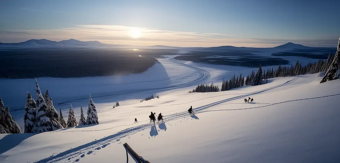
Reindeer herding corridors across northern Norway, Sweden, Finland, and Russia constitute one of Europe’s oldest continuous land-use systems.挪威、瑞典、芬兰和俄罗斯北部的驯鹿放牧通道,构成了欧洲历史最悠久且持续至今的土地利用体系之一。
-
These routes resist fixed cartographic representation because seasonal ice conditions and snowpack depth redefine viable paths annually.这些路线难以用固定地图呈现,因为每年的海冰状况和积雪深度都会重新定义可行路径。
-
Herders transmit route knowledge through narrative rather than GPS coordinates—stories encode wind patterns, lichen quality, and calving terrain.牧民通过口述叙事而非GPS坐标传承路线知识——故事中蕴含风向规律、地衣品质与产犊地形信息。
-
Cross-border grazing agreements predate modern nation-states yet now face legal friction under EU environmental directives.跨境放牧协议早于现代民族国家出现,却因欧盟环保指令而面临法律冲突。
-
Climate change compresses migration windows: calving now occurs up to three weeks earlier than in 1990, disrupting intergenerational timing cues.气候变化压缩了迁徙窗口:如今产犊时间比1990年提前最多三周,打乱代际时间节律。
-
Young herders blend satellite telemetry with grandmother-taught star navigation to validate shifting trail viability.年轻牧民将卫星遥测技术与祖母传授的星辰导航法结合,验证迁徙路径的实时可行性。
-
State mapping projects often erase these routes as 'unofficial' despite their constitutional recognition in Norway and Sweden.国家测绘项目常将这些路线标记为‘非正式’而予以抹除,尽管挪威和瑞典宪法已承认其地位。
-
Winter pasture access disputes intensify as mining concessions fragment traditional movement corridors near Kiruna and Gällivare.随着采矿特许权在基律纳和耶利瓦勒附近分割传统迁徙走廊,冬季牧场准入争端日益加剧。
-
Reindeer droppings, tracked via spectral analysis, reveal subtle shifts in forage selection that precede visible vegetation change.借助光谱分析追踪驯鹿粪便,可发现觅食选择的细微变化,早于植被可见改变。
-
The routes function less as lines on a map and more as negotiated, embodied treaties with permafrost and tundra.这些路线并非地图上的线条,而是牧民与永久冻土及苔原之间动态协商、身体践行的契约。
-
Legal scholars argue that recognizing these pathways as dynamic jurisdictional zones could reshape Arctic governance models.法学学者指出,若将这些路径承认为动态管辖区域,或将重塑北极治理模式。
-
To map them statically is to misread their essence: they are verbs, not nouns.静态绘图即是对其实质的误读:它们是动词,而非名词。