地理漫步·世界地理英语30篇(4)
23 / 30
正在确认阅读权限…
The Loess Plateau: Wind-Deposited Soil and Anthropogenic Erosion Feedback Loops
黄土高原:风积成土与人为侵蚀的正反馈循环
-
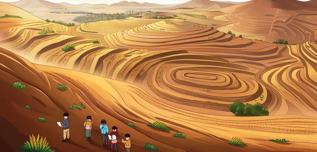
The Loess Plateau covers over 640,000 km² with some of Earth’s thickest wind-blown silt deposits.黄土高原面积逾64万平方公里,拥有地球上最厚的风成粉砂沉积层之一。
-
Monsoon-driven winter winds carried fine dust from Central Asian deserts over millions of years.季风驱动的冬季风历经数百万年,将中亚沙漠的细尘吹送至此。
-
Steep slopes and sparse vegetation make the loess highly susceptible to water erosion during summer rains.陡峭坡地与稀疏植被使黄土在夏季降雨时极易遭受水蚀。
-
Centuries of terracing and deforestation intensified gully formation and sediment runoff into the Yellow River.数百年来的梯田开垦与森林砍伐加剧了沟壑发育及向黄河输送泥沙。
-
Soil loss rates once exceeded 10,000 tons per km² annually in severely degraded areas.严重退化区域的土壤流失速率曾高达每年每平方公里1万吨以上。
-
Grassland restoration and check-dam construction have reduced sediment loads by nearly 50% since 2000.自2000年以来,草地恢复与淤地坝建设使泥沙输移量减少了近50%。
-
Land-use zoning now reflects slope gradient, rainfall intensity, and soil erodibility indices.土地利用分区现依据坡度、降雨强度和土壤可蚀性指数制定。
-
Remote sensing shows vegetation recovery correlates strongly with micro-topographic shelter and runoff interception.遥感显示,植被恢复程度与微地形庇护效应及径流截留能力密切相关。
-
This plateau illustrates how climatic deposition history interacts with human land management across spatial scales.该高原展现了气候沉积历史与人类土地管理在多空间尺度上的交互作用。
-
Its transformation highlights feedback loops between geomorphology, hydrology, and agrarian policy.其转型凸显了地貌、水文与农业政策之间的反馈循环。