地理漫步·世界地理英语30篇(4)
28 / 30
正在确认阅读权限…
The Scandinavian Peninsula: Glacial Legacy and Isostatic Rebound Gradients
斯堪的纳维亚半岛:冰川遗产与地壳均衡回弹梯度
-
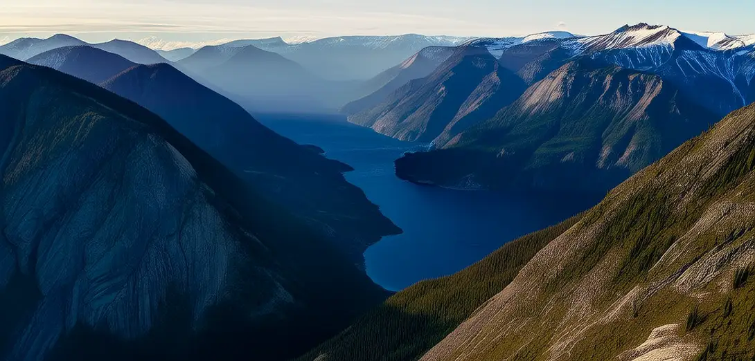
Deep ice sheets once covered this landmass, leaving behind U-shaped valleys and fjord systems open to the North Sea.深厚的冰盖曾覆盖这片陆地,留下了面向北海的U形谷和峡湾系统。
-
Post-glacial rebound lifts coastal areas fastest where ice was thickest—especially in northern Sweden and Finland.冰后期回弹在冰层最厚处(尤其是瑞典北部和芬兰)使沿海地区抬升最快。
-
Sea-level change here is not uniform: some coasts rise while others subside due to forebulge collapse.这里的海平面变化并不均匀:部分海岸上升,而另一些则因前隆塌陷而下沉。
-
Raised beaches appear as terraces at different elevations, marking ancient shorelines preserved in granitic bedrock.抬升的海滩以不同海拔的阶地形式出现,标记着保存在花岗岩基岩中的古海岸线。
-
Glacial till and drumlin fields align with former ice-flow directions mapped using satellite elevation data.冰碛物和鼓丘群的走向与利用卫星高程数据绘制的古冰流方向一致。
-
Lakes fill glacially scoured basins, their outlets shifting as land uplift alters drainage divides gradually.湖泊充填冰川刨蚀形成的洼地,其出口随陆地上抬导致分水岭缓慢迁移而改变。
-
Coastal archipelagos grow larger as rebound exposes new land, increasing habitat fragmentation for island species.随着回弹暴露新陆地,沿海群岛不断扩大,加剧了岛屿物种的栖息地破碎化。
-
Peat bogs accumulate unevenly because water tables respond differently to uplift versus climate-driven precipitation shifts.泥炭沼泽沉积不均,因为地下水位对抬升和气候驱动的降水变化响应各异。
-
Bedrock fractures control spring locations where groundwater emerges along rebound-induced tilt lines.基岩裂隙控制着泉水出露位置,地下水沿回弹引发的地表倾斜线涌出。
-
Modern GPS measurements track millimeter-scale uplift rates that vary over distances less than fifty kilometers.现代GPS测量可追踪毫米级的抬升速率,且该速率在不足五十公里的距离内即有变化。