地理漫步·世界地理英语30篇(4)
29 / 30
正在确认阅读权限…
The Chihuahuan Desert: Basin-and-Range Topography and Ephemeral Playa Hydrology
奇瓦瓦沙漠:盆岭地貌与间歇性盐湖水文
-
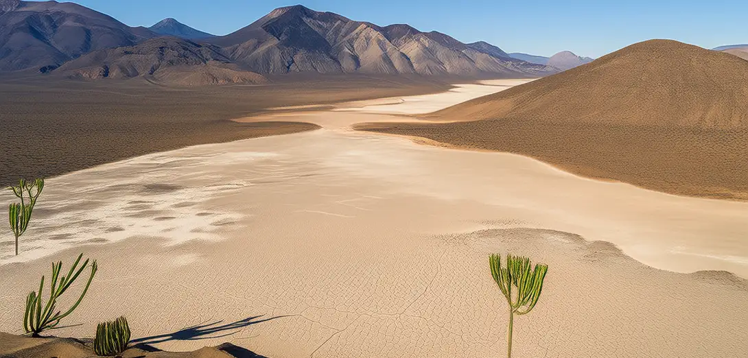
Stretching across northern Mexico and southwestern US, this desert features alternating mountain ranges and sediment-filled basins.这片沙漠横跨墨西哥北部和美国西南部,地貌以交错分布的山脉与沉积物填充的盆地为特征。
-
Rainfall rarely penetrates deeply, so most water flows across surfaces toward closed depressions called playas.降雨极少渗入深层,大部分水分沿地表流向称为盐湖的封闭洼地。
-
Playa floors hold evaporite minerals like gypsum and halite deposited during brief flooding episodes.盐湖湖床沉积着石膏、石盐等蒸发盐矿物,由短暂洪水事件形成。
-
Wind erodes exposed playa sediments, generating dust storms that affect air quality hundreds of kilometers away.风力侵蚀裸露的盐湖沉积物,引发沙尘暴,影响数百公里外的空气质量。
-
Aquifers beneath basins rely on rare recharge events funneled through fractured limestone ridges bordering the desert.盆地下的含水层依赖罕见的补给事件,雨水经沙漠边缘破碎石灰岩山脊渗入。
-
Vegetation bands follow subtle elevation changes where subsurface moisture concentrates near basin edges.植被带随微小高程变化呈带状分布,因地下水分在盆地边缘富集所致。
-
Fault-controlled topography directs runoff paths, making flash floods highly localized and geomorphically significant.受断层控制的地貌引导径流路径,使山洪高度局地化且对地貌演化意义重大。
-
Soil salinity gradients mirror distance from playa centers, shaping plant community zonation patterns.土壤盐分梯度随距盐湖中心距离增加而变化,塑造了植物群落的带状分布格局。
-
Nighttime temperature drops cause dew condensation on desert pavements, sustaining cryptobiotic soil crusts.夜间降温使露水凝结于荒漠砾幕表面,维系着隐生土壤结皮的生存。
-
Remote sensing detects seasonal soil moisture pulses invisible to ground observation but critical for seed germination.遥感技术可探测地面观测无法识别的季节性土壤湿度脉冲,这对种子萌发至关重要。