地理漫步·世界地理英语30篇(4)
15 / 30
正在确认阅读权限…
The Deccan Plateau: Volcanic Terrain Influencing Monsoon Rainfall and Agriculture
德干高原:火山地貌影响季风降水与农业格局
-
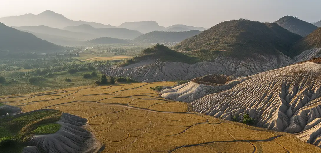
The Deccan Plateau covers much of peninsular India and formed from massive volcanic eruptions 66 million years ago.德干高原覆盖了印度半岛大部分地区,形成于6600万年前的大规模火山喷发。
-
Its basalt bedrock weathers slowly, creating nutrient-rich black cotton soils ideal for cotton and sorghum cultivation.其玄武岩基岩风化缓慢,形成养分丰富的黑棉土,非常适合种植棉花和高粱。
-
Western Ghats intercept monsoon winds, causing heavy rainfall on the windward side and aridity eastward across the plateau.西高止山脉拦截季风,导致迎风坡降雨丰沛,而高原东部则干旱少雨。
-
Rivers like the Krishna and Godavari flow eastward, carving broad valleys through layered lava flows.克里希纳河与戈达瓦里河等河流东流而下,在层层火山熔岩中切割出宽阔河谷。
-
Groundwater storage is high in fractured basalt, supporting wells even during prolonged dry seasons.破碎玄武岩中地下水储量丰富,即便在长期旱季也能维持水井供水。
-
Laterite caps on elevated ridges indicate past tropical weathering under warmer, wetter climates.高地山脊上的红土层表明,这里曾经历过温暖湿润气候下的热带风化作用。
-
Urban expansion around cities like Hyderabad stresses aquifers faster than natural recharge can replenish them.海得拉巴等城市周边的城市扩张,使含水层枯竭速度超过自然补给能力。
-
Terraced farming on gentle slopes reduces erosion while conserving moisture in semi-arid sub-regions.在缓坡上实施梯田耕作,既减少水土流失,又在半干旱次区域保持土壤水分。
-
Solar radiation intensity here supports large-scale photovoltaic farms built on marginal agricultural land.此处太阳辐射强度高,适宜在边际农用地上建设大规模光伏电站。
-
Soil degradation from over-cropping and declining organic matter threatens long-term food security across the plateau.过度耕作与有机质下降导致土壤退化,威胁整个高原的长期粮食安全。