地理漫步·世界地理英语30篇(4)
3 / 30
正在确认阅读权限…
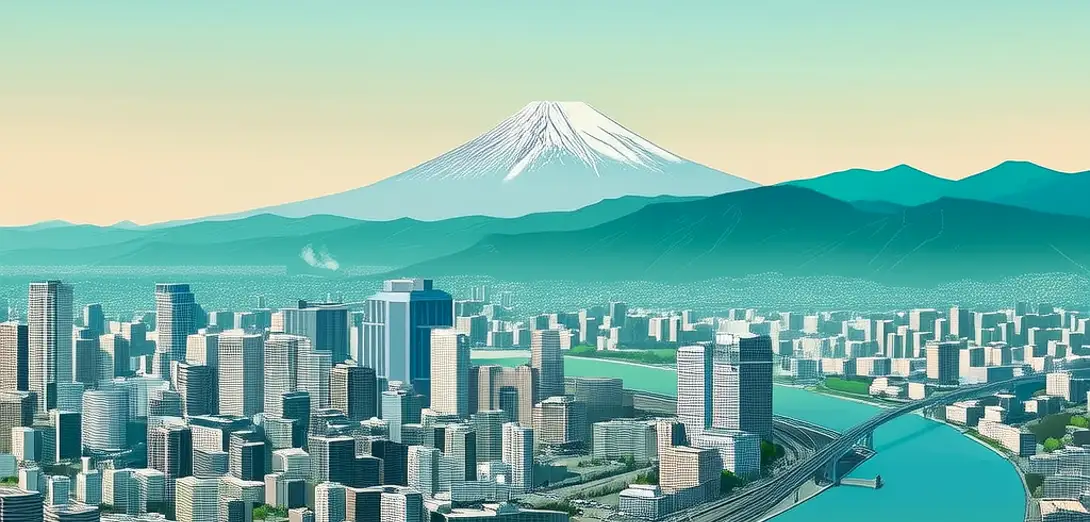
Tokyo: A Megacity Shaped by Geography and Risk
东京:地理与风险塑造的巨型城市
-
Tokyo sits on a coastal plain bordered by mountains, volcanoes, and active fault lines.东京坐落于沿海平原,四周环山、火山及活跃断层。
-
Its dense urban fabric developed partly because flat land covers only 30% of the region.城市密集的建成区部分源于该地区仅30%为平地。
-
The city relies on imported water, as local rivers lack sufficient volume for 37 million people.东京依赖外调水源,因本地河流水量不足以供应3700万人口。
-
Subways run deep underground to avoid liquefaction-prone reclaimed land near Tokyo Bay.地铁深埋地下,以避开东京湾附近易液化的填海土地。
-
Earthquake-resistant engineering standards were strengthened after the 1923 Great Kanto quake.1923年关东大地震后,抗震工程标准得到加强。
-
Urban heat islands raise summer temperatures up to 3°C above rural surroundings.城市热岛效应使夏季气温比周边乡村高出最多3℃。
-
Green roofs and rooftop gardens help absorb rainwater during typhoon season.绿色屋顶和屋顶花园有助于台风季吸收雨水。
-
Public transport carries over 40 million passengers daily, reducing per-capita emissions.公共交通日均运送超4000万人次,降低人均碳排放。
-
Coastal flood barriers protect low-lying districts from storm surges and sea-level rise.海岸防洪屏障保护低洼城区免受风暴潮和海平面上升影响。
-
Community disaster drills occur quarterly, reinforcing preparedness culture across generations.社区防灾演练每季度举行一次,代代传承防灾文化。