地理漫步·世界地理英语30篇(4)
4 / 30
正在确认阅读权限…
The Sahel: A Transitional Zone Under Pressure
萨赫勒地区:承受压力的过渡地带
-
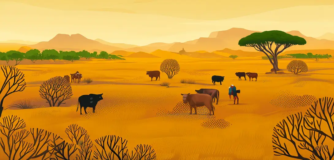
The Sahel stretches across Africa just south of the Sahara Desert, from Senegal to Sudan.萨赫勒地区横跨非洲,位于撒哈拉沙漠以南,西起塞内加尔,东至苏丹。
-
It marks a climatic transition where semi-arid grasslands meet arid desert conditions.它标志着半干旱草原向干旱沙漠气候过渡的地带。
-
Rainfall here is highly variable—some years bring floods, others cause severe drought.此地降雨极不稳定——有些年份洪涝成灾,有些年份则遭遇严重干旱。
-
Pastoralists migrate seasonally with livestock, adapting to shifting pasture and water sources.牧民随季节迁徙放牧,根据草场和水源的变化灵活调整。
-
Population growth and crop expansion have reduced natural vegetation cover since the 1970s.自20世纪70年代以来,人口增长与耕地扩张导致天然植被覆盖减少。
-
Desertification isn’t just sand advancing—it’s soil degradation and loss of biological crusts.荒漠化不仅是沙丘推进,更表现为土壤退化和生物结皮丧失。
-
Dams on the Niger River alter downstream flooding patterns essential for flood-recession farming.尼日尔河上的水坝改变了下游洪水模式,而这种洪水对汛退农业至关重要。
-
Acacia trees planted in agroforestry systems improve soil nitrogen and reduce wind erosion.农林复合系统中种植的金合欢树可提升土壤氮含量,并减轻风蚀。
-
Early-warning systems now combine satellite rainfall data with local pastoralist knowledge.如今的早期预警系统融合卫星降雨数据与当地牧民知识。
-
Youth-led cooperatives restore degraded land using contour bunds and native seed banks.由青年主导的合作社利用等高线埂和乡土种子库修复退化土地。